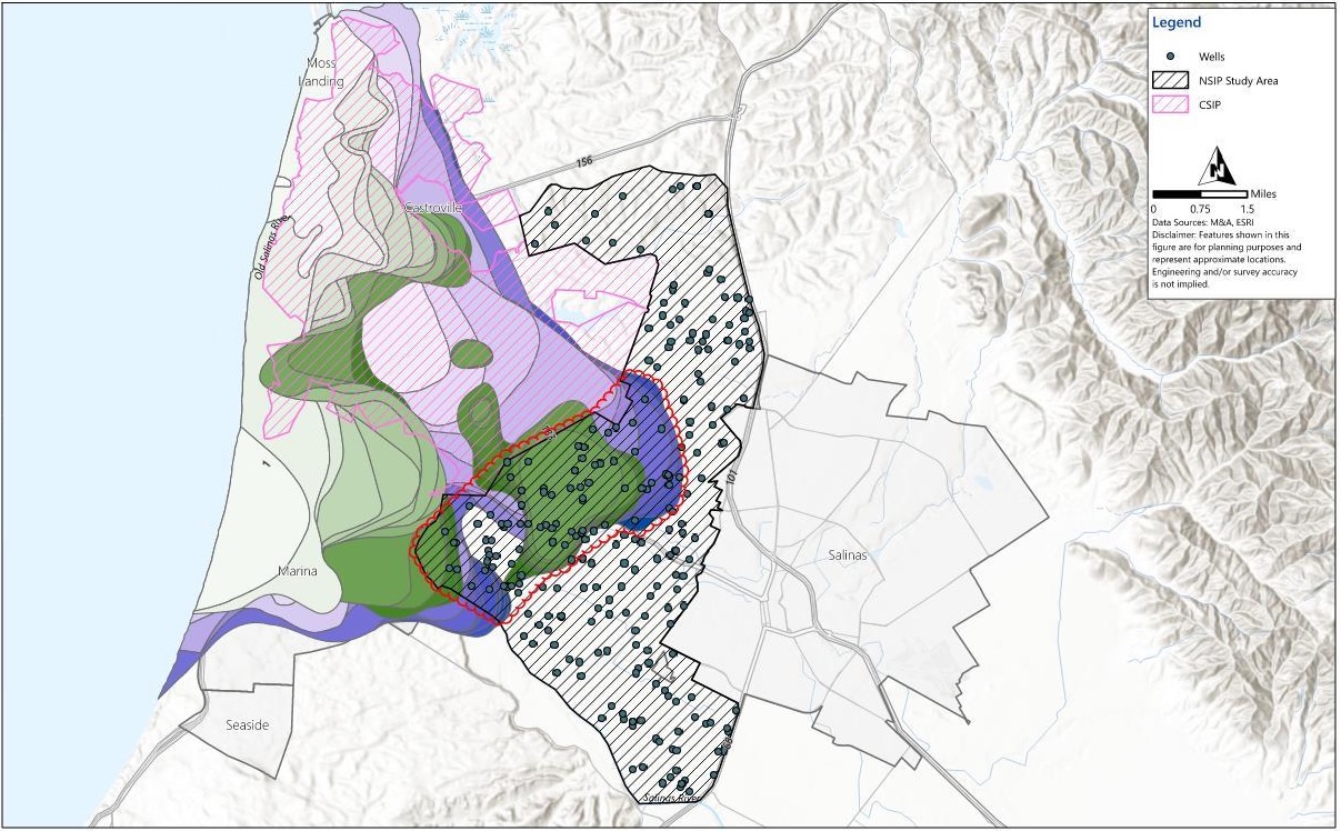
Over 95% of water used within the Salinas Valley is sourced from managed groundwater resources, supporting families, communities, and a world-class agricultural economy. Groundwater in parts of the 180/400‑Foot Aquifer and the Eastside Aquifer subbasins is under stress from the gradual inland progression of seawater intrusion, driven by chronically declining groundwater levels below sea level.
To support long‑term sustainability, SVBGSA is partnering with Monterey County Water Resources Agency (MCWRA) to evaluate potential alternative supplies and infrastructure to reduce reliance on coastal groundwater. In March 2026, SVBGSA and MCWRA completed a preliminary feasibility study for a New Seawater Intrusion Project (NSIP).
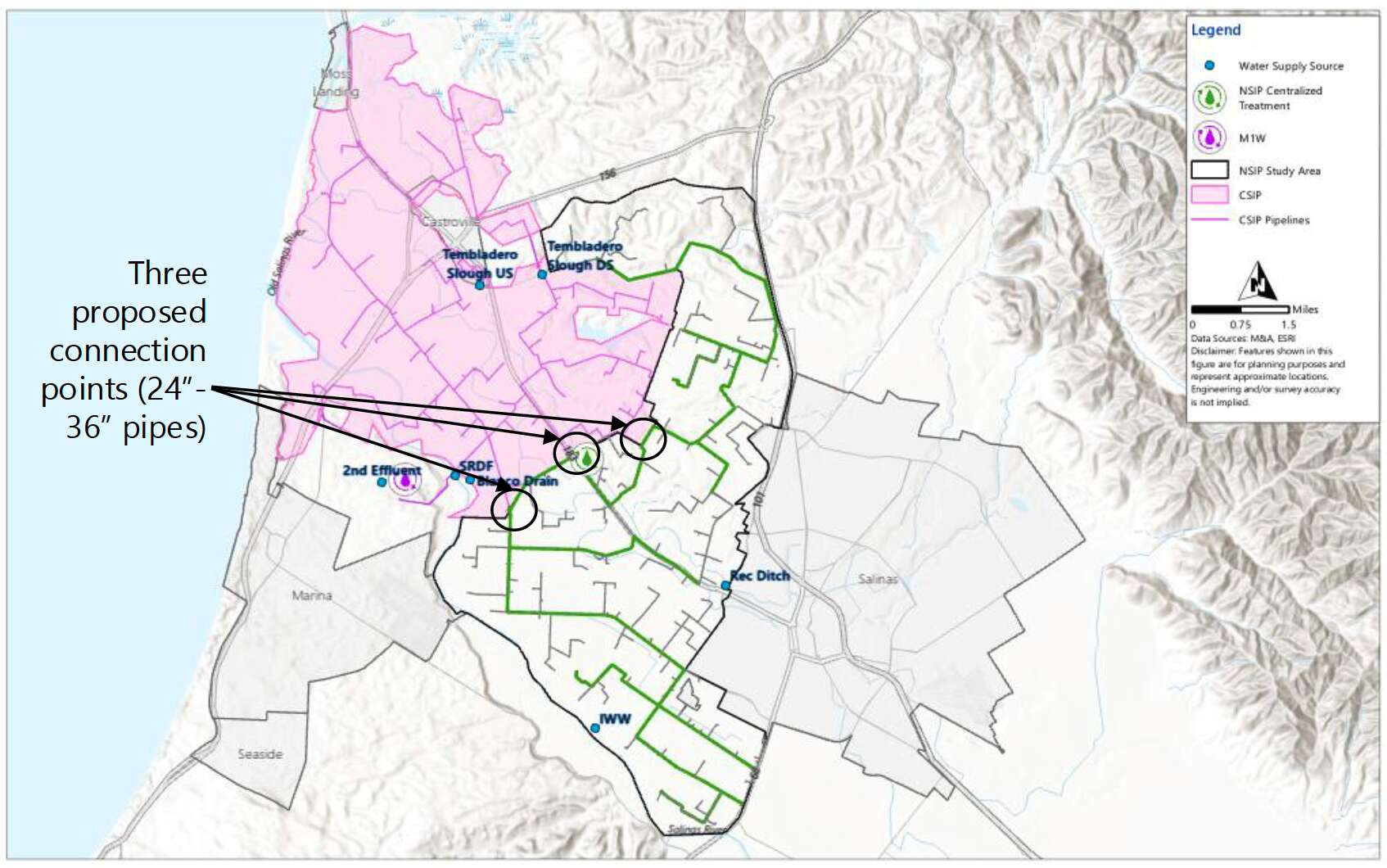
The study evaluates expanding delivery of alternative water supplies beyond the existing Castroville Seawater Intrusion Project (CSIP) service area to inland agricultural lands, with the goal of reducing reliance on groundwater.
What’s Being Studied
The NSIP feasibility study included the following steps:
- 1
Identify potential source waters for irrigation.
- 2
Prioritize areas and users that would benefit most.
- 3
Assess infrastructure needs including pipes, pumps, storage and treatment.
- 4
Develop alternatives that pair water sources with delivery systems and estimate costs.
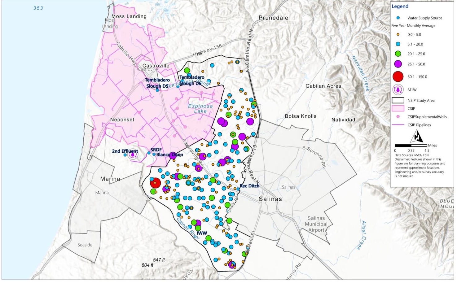
The study evaluated potential water sources — including recycled water, industrial wastewater, local drainages and ditches, and Salinas River diversions using Permit 11043 — their availability and quality, and the infrastructure needed to deliver water where it’s most needed. Groundwater demand in the study area averages roughly 28,000 acre-feet per year, concentrated in the 400-foot and Deep Aquifers.
Project Scenarios
NSIP is aimed at balancing groundwater protection benefits with realistic supply, infrastructure, and operational constraints. These more targeted or incremental approaches offer practical near-term benefits with lower complexity. Three conceptual scenarios are identified to understand the range of options for NSIP.
Scenario 1 — Maximum NSIP System
- Serves all identified wells in the NSIP area (~251 wells)
- Offsets about 27,600 acre‑feet per year
- Requires extensive infrastructure (31 miles of main pipeline, 42 miles of laterals)
- Needs significant seasonal storage (~18,000 AF) to match supply timing with irrigation demand
Scenario 2 — Intruded Zone Focus
- Targets wells within the existing seawater intrusion zone (~88 wells)
- Offsets about 11,000 acre‑feet per year
- Requires less infrastructure (about 12 miles of main and 10 miles of laterals)
- Most offset could be achieved through direct delivery with some storage (~4,500 AF)
Scenario 3 — CSIP Expansion
- Evaluates expanding the existing CSIP system
- Uses excess winter recycled water supplies (~860 AF in November)
- Offers a lower‑cost, incremental reduction in groundwater pumping
- Does not fully meet peak season irrigation demand but provides benefit when water is available