
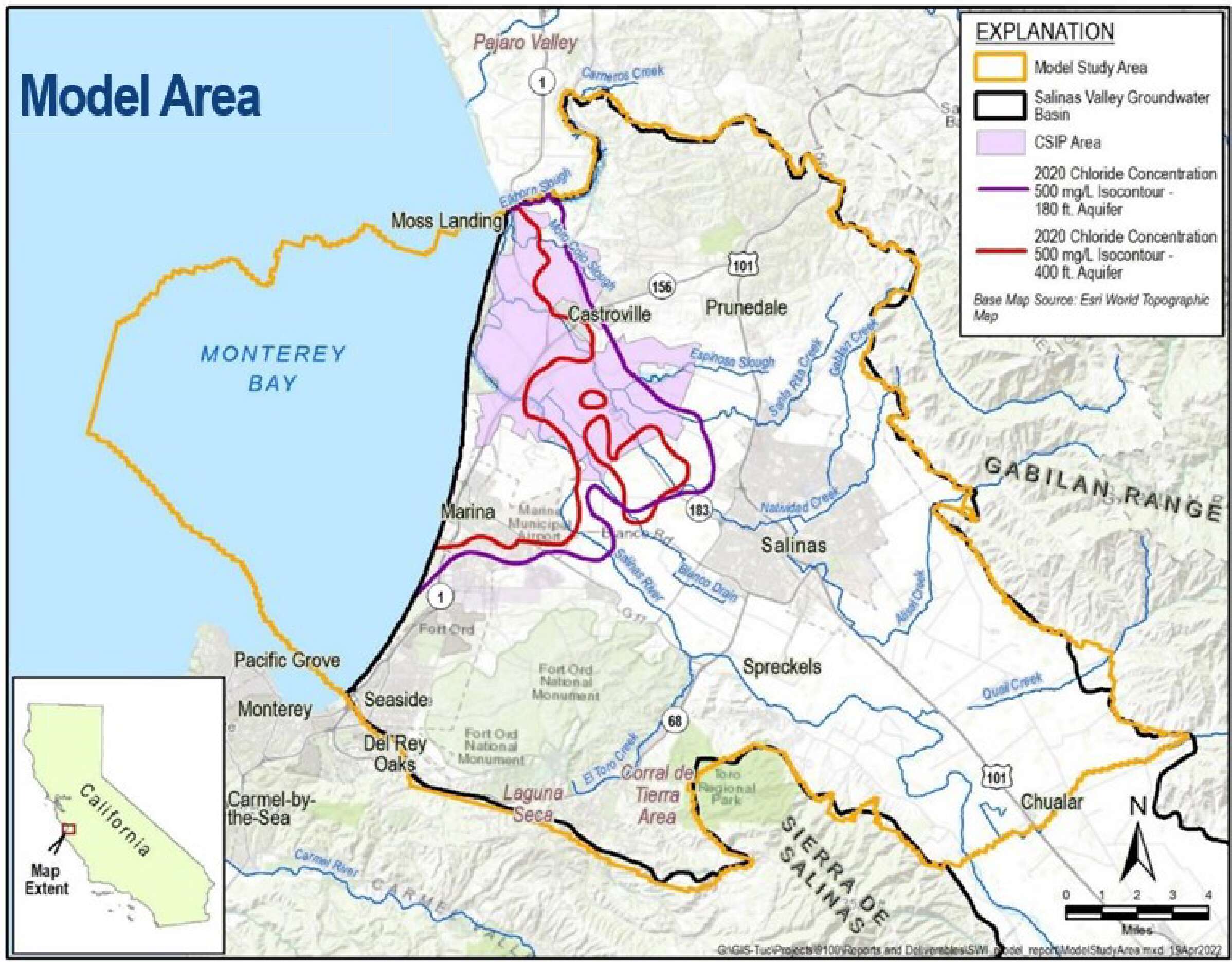
 The Salinas Valley Seawater Intrusion Model (SWI Model) is a tool to assist with addressing seawater intrusion in the Salinas Valley. Other existing groundwater flow models of the Salinas Valley did not have the ability to account for the differing densities of freshwater, seawater and brackish water. The SWI Model includes the ability to account for transport due to density differences. The Seawater Intrusion Model is being used to better assess, compare, and design projects and management actions to reach their sustainability goals.
The SWI Model builds on existing groundwater models of the region, including the Monterey Subbasin Groundwater Flow Model developed by EKI Environment and Water for Marina Coast Water District Groundwater Sustainability Agency (MCWD GSA), the Salinas Valley Integrated Hydrologic Model (SVIHM) 1,2 under development by the U.S. Geological Survey, the North Marina Groundwater Model and the Seaside Basin Model.
For more information, please see the model report, which covers model development and calibration for the entire expanded area of the model, and the addendums to this report, which documents refinements and updates made to the SWI Model since the initial report’s preparation.
- Addendum 1 documents updates made as of January 2024
- Addendum 2 documents additional updates made as of November 2024