Click to enlarge
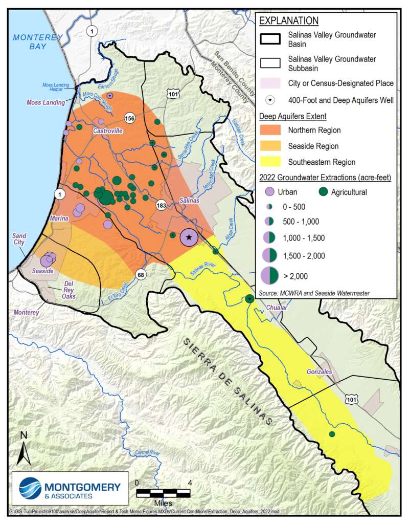
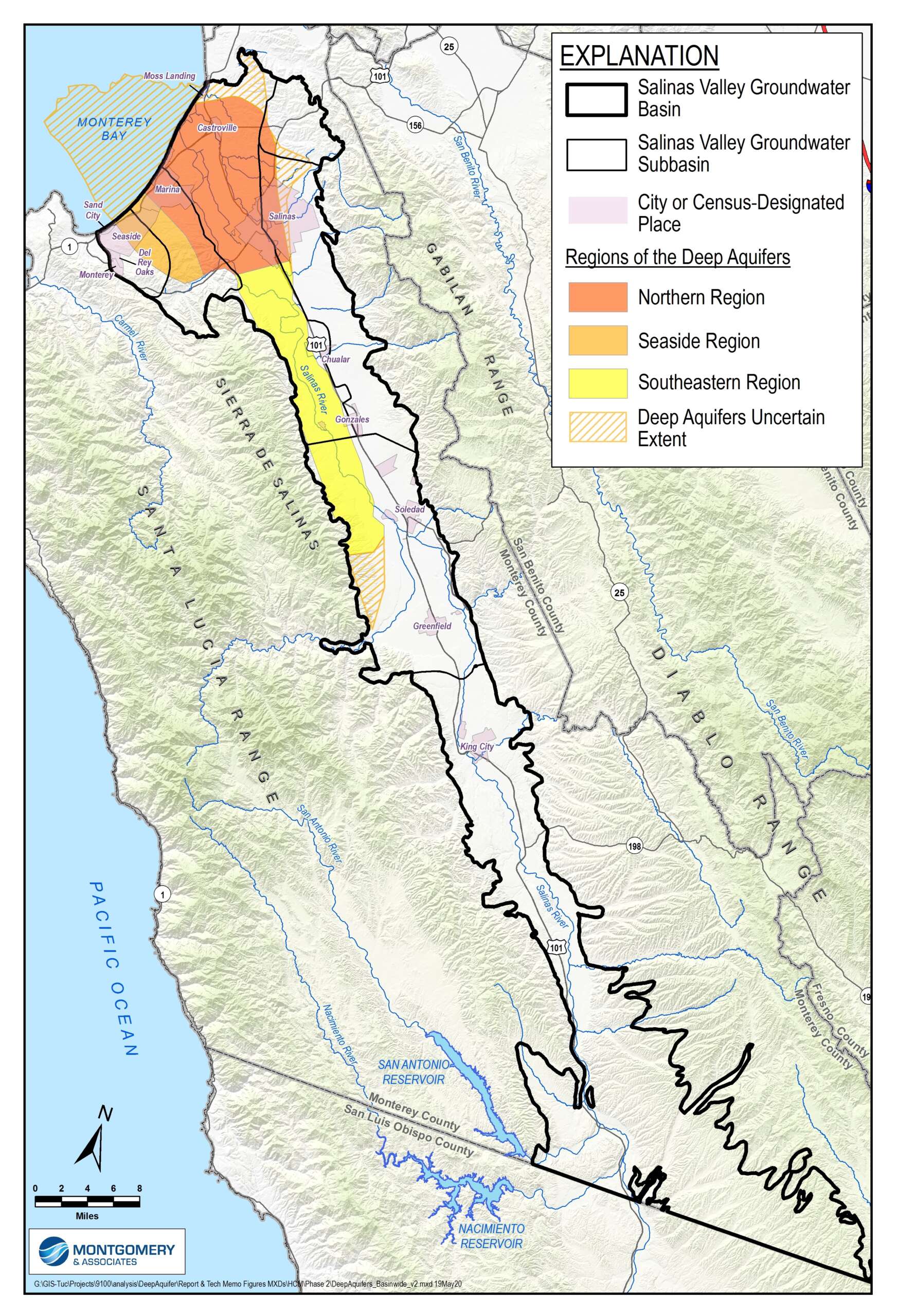
The groundwater basin where the Salinas Valley meets the coast is a layered aquifer system. The barriers within the layered aquifer system, called aquitards, create unique aquifers called the 180-Foot, 400-Foot and Deep Aquifers. As seawater intruded into the upper two aquifers — the 180-Foot and 400-Foot Aquifers — both municipal and agricultural wells were drilled deeper into the Deep Aquifers at depths of 900 to 2,100 feet.
While the Deep Aquifers have become an important source of water, groundwater levels in many Deep Aquifers wells have declined dramatically and led to questions regarding the risk of seawater intrusion and whether they receive any inflow. This scientific study of the Deep Aquifers was prepared to better understand the conditions of the Deep Aquifers, the geographic extent and hydrogeologic characteristics. SVBGSA, MCWRA, water districts, regulated utilities, and irrigated agriculture have jointly funded the Deep Aquifers Study, recently completed by Montgomery & Associates.
The study reaffirms the critical state of overdraft and risks to this source of water supplies. The study highlights the risk of seawater intrusion and land subsidence along the coast if pumping and groundwater level declines continue in the Deep Aquifers. It confirms that sufficient data exists to manage the Deep Aquifers and provides scientific guidance for management and monitoring.