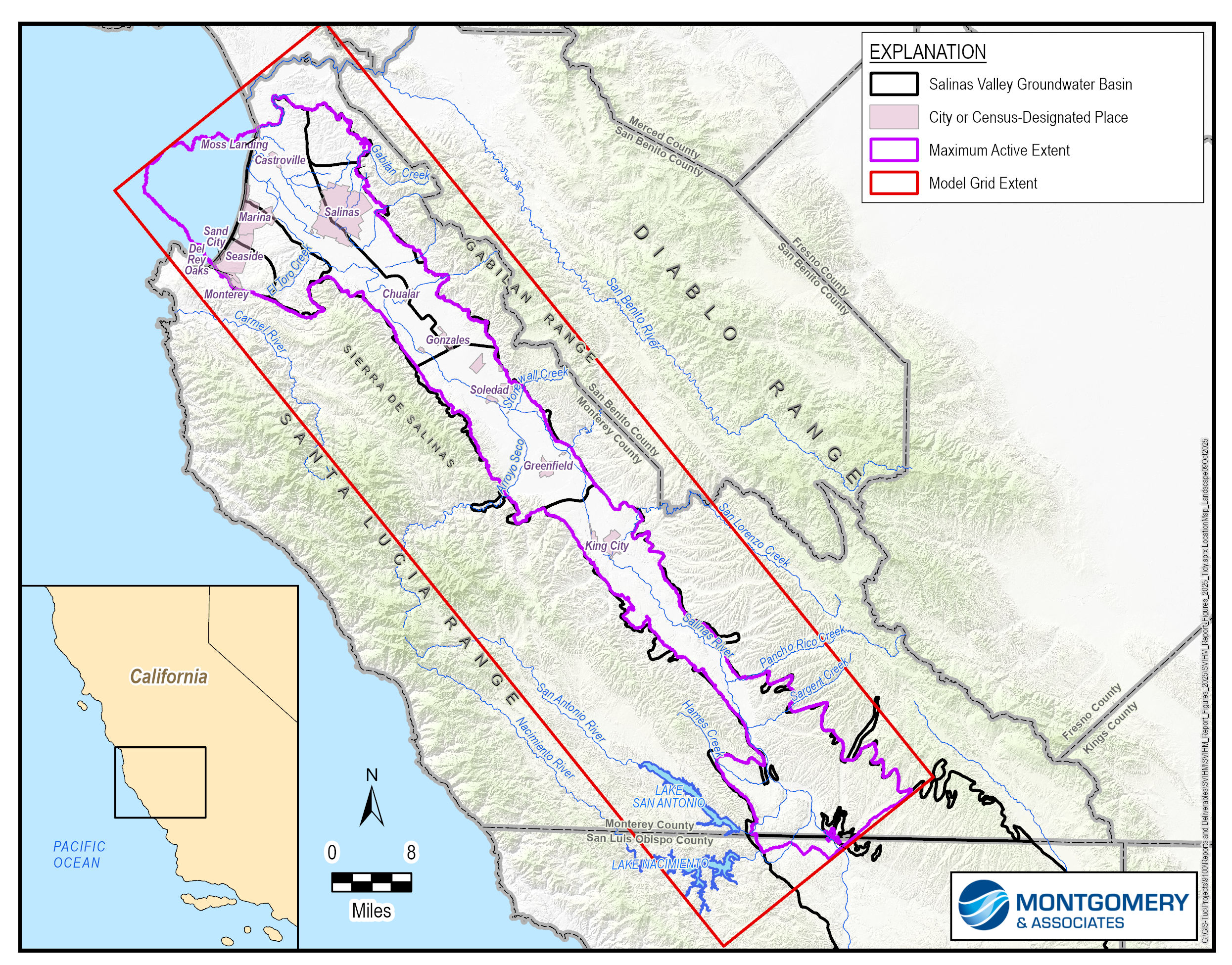
Salinas Valley Integrated Hydrologic Model
- A geologic model that turns the 3-dimensional aquifers and aquitards into model layers
- A watershed model that estimates streamflow inputs
- A surface water/groundwater flow model that simulates how water moves throughout the Valley
In April 2025, USGS published the SVIHM, providing a foundation for better understanding and managing water resources in the region.
Since work on the SVIHM began, additional data has been collected to support groundwater sustainability planning under California’s Sustainable Groundwater Management Act (SGMA). On behalf of SVBGSA, Montgomery & Associates updated the SVHIM with the latest information, working together with agency partners. These updates improve the model’s accuracy and make it more useful for long-term groundwater planning and SGMA compliance.
Building on the SVIHM, the USGS also developed the Salinas Valley Operational Model (SVOM) as a predictive tool that adds current water management operations. SVOM includes operational rules for when water is released from the Nacimiento and San Antonio Reservoirs, and when water is redirected at the Salinas River Diversion Facility to support the Castroville Seawater Intrusion Project. Montgomery & Associates developed a new version based on the updated SVIHM and ran it with a representative climate period to establish a baseline scenario. This baseline provides a consistent foundation for evaluating projects and actions aimed at meeting groundwater sustainability goals across the Valley.
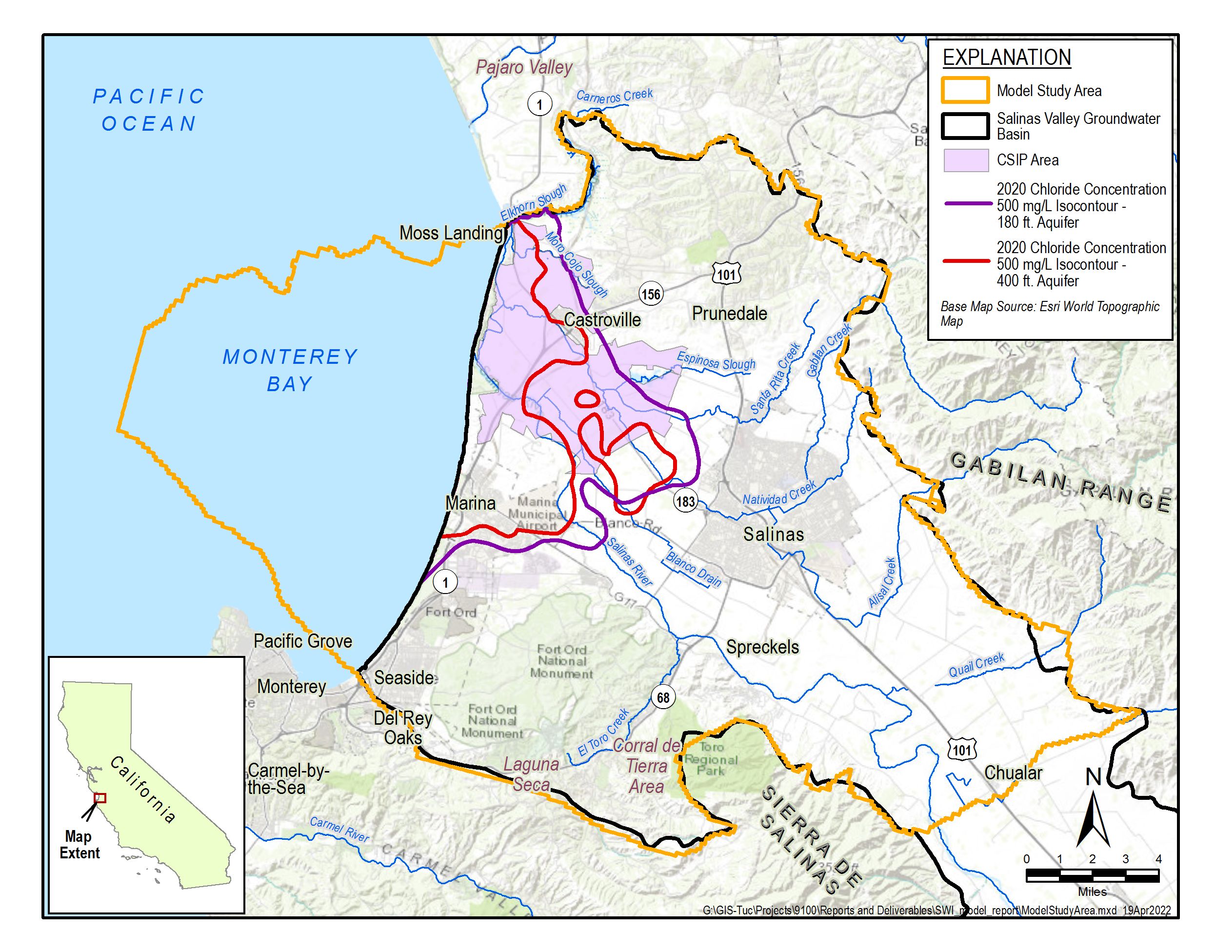
Seawater Intrusion Model
SVBGSA engaged Montgomery & Associates to develop the model in 2021, with ongoing updates aimed at continually improving model performance and accuracy. The Seawater Intrusion Model (SWIM) builds on existing groundwater models of the region, including the Monterey Subbasin Groundwater Flow Model developed by EKI Environment and Water for Marina Coast Water District Groundwater Sustainability Agency (MCWD GSA), the Salinas Valley Integrated Hydrologic Model (SVIHM) developed by the U.S. Geological Survey, the North Marina Groundwater Model and the Seaside Basin Model. In 2025, the SWIM and SVIHM were improved concurrently with structural revisions to the SVIHM, the updated HCM, and revised calibration datasets.
For more information, please see the model report (v0), which covers model development and calibration for the entire expanded area of the model, and the addendums to this report, which documents refinements and updates made to the SWIM since the initial report’s preparation.
Addendum 1 documents updates made as of January 2024 (v1)
Addendum 2 documents additional updates made as of November 2024 (v2)
Addendum 3 documents additional updates made as of October 2025 (v3)